Virtual Grand Canyon Desert View, Geographical Overview Of The South RiM
Virtual Tusayan simulated flight to Grand Canyon South Rim, a geographical overview in simulated flight
of the Grand Canyon South Rim as can be seen from the Grand Canyon Desert View Watchtower as well as on
actual Grand Canyon helicopter tours. Information about Grand Canyon tours and a Grand Canyon Webcam will
also be presented.
Views included in Grand Canyon Airport Tour include: Tusayan, Grand Canyon Village, Grand Canyon
South Rim, Bright Angel Point, Yualapai Point and Mather Point, Sockdolager Rapids, Hance Rapids, Nevils
Rapids, Tanner Canyon Rapids and Lava Canyon Rapids. Refer to the Google Earth Map for more.
Contents:
Grand Canyon South Rim Tour Part 2 - Desert View FlyoverVirtual Grand Canyon South Rim Tour Descriptions
More Virtual Grand Canyon South Rim Tours
Grand Canyon South Rim Tour Part 3 - Desert View Flyover
View Desert View Flyover in a larger map Back To Top
Virtual Grand Canyon South Rim Tour Descriptions
Virtual Desert View Flyover (The tour seen above)
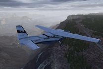
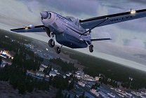
In part three of the Grand Canyon South Rim Tour we find ourselves flying north just east of the eastern rim
alongside Hwy 64 towards Desert View. As we fly over the rim we get a good view of Desert View off our right
wing. We also get a broad view of the Grand Canyon off our left wing with distance views of Tusayan and Grand
Canyon Village. Popular Grand Canyon River rapids are also seen a mile below such as Sockdolager Rapids,
Hance Rapids, Nevill's Rapid, Tanner Canyon Rapids and Lava Canyon Rapids which range from level 2 to 9 in
difficulty rating.
This Virtual Desert View Tour video was created under Microsoft’s “Game Content Usage Rules” using assets from Flight Simulator X, © Microsoft Corporation.
More Grand Canyon information coming soon.
___Panorama Views: Click on the camera below then select desired view on right.
Webcam: Yavapai Point view west-a must see at sunset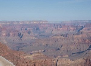 |
Lee's Ferry and Marble Canyon view from Horseshoe Bend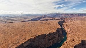 |
When its your turn to control the camera, use the mouse to control view. Back To Top
More Grand Canyon South Rim Tours
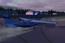
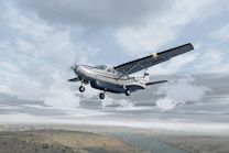
Grand Canyon South Rim Tour Part 1 - Grand Canyon Airport
Virtual Grand Canyon Airport is the first part of this Virtual Grand Canyon South Tours series and begins with
a tour overview while we taxi to the runway. The tour overview explains the overall plan to follow the . . .
Grand Canyon South Rim Tour Part 2 - Tusayan To Grand Canyon South Rim
In this second part of our Grand Canyon South Rim Tour we begin by taking off from Grand Canyon Airport
runway 3 then proceed to fly over Grand Canyon Camper Village and Tusayan. We bank towards the . . .
Grand Canyon East Rim Tour Landing - Lake Powell To Page Airport
In this final part of the Virtual Grand Canyon South Rim tour series we begin with views over Wahweap Bay, Lake
Powell on the Utah side while on a east heading. We almost immediately bank back to the south over the Arizona
state line to merge and align with Page Municipal Airport approach.. . .
Check back for new Virtual Travel Tours, or Subscribe to VTT RSS Feed for updates
Virtual Desert View Flyover Go Back To Video Tour
Please Comment and Share
Back To Top
Site optimized for Firefox
_Download
More Tours
Tusayan To Grand Canyon South Rim
Comment on this video? click here


New! Comments
This site is still in its development stage. Please let me know what you think about this page.