Virtual Grand Canyon West, Grand Canyon South Rim And Grand Canyon Tours
Virtual Grand Canyon West Tours, a geographical overview of the Grand Canyon West Rim using simulated
flight over Grand Canyon National Park, Colorado River rafting rapids, Grand Canyon Village and other vistas.
Information about Grand Canyon helicopter Tours and other types of Grand Canyon tours are also presented
here. Video tours on this page show a massive Grand Canyon National Park inching closer before landing in
Tusayan.
____________________________________________________________Grand Canyon Center 45 miles ahead east: fsx

Contents:
Grand Canyon West Tour Part 1 - Whitmore Wash To 205 Mile RapidsGrand Canyon West Tour Part 2 - Gateway Rapids To Whitmore Wash
Grand Canyon West Tour Part 3 - Upset Rapids To Gateway Rapids
Grand Canyon West Tour Part 4 - Tapeats Rapids To Kanab Rapids
Grand Canyon West Tour Part 1 - Whitmore Wash To 205 Mile Rapids
Before starting here is an experience given by a local tour operator more down to earth:
A rugged terrain tour on a custom built "Tour Trekker" that begins with a crossing over the Hoover Dam bypass
bridge and on through the Joshua Tree Forest on your way to the Hualapai Indian Reservation on the Grand
Canyon West Rim. I'll provide a link to a full page description and itinerary of this and other Grand Canyon
tours soon.
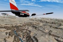
Now for the first of Virtual Grand Canyon West Tours:________________________Click image for the tour
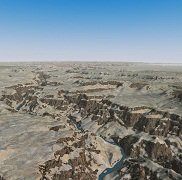
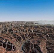
In the first part of the Virtual Grand Canyon West Tours series we begin near
the western edge of the Grand Canyon Wist Rim as we make our way to the
South Rim. We fly high above the Colorado River upstream with the Hualapai
Indian Reservation to the east and south and Lake Mead National Recreation
Area to the north and west. We end this part of the tour over Whitmore Wash
and Grand Canyon National Park ahead in the distance . . . more.
Be sure to use the accompanying Google Map in Earth mode to help identify the sights.
View Price Point To Whitmore Wash Flight Plan in a larger map Back To Top
Grand Canyon West Tour Part 2 - Gateway Rapids To Whitmore Wash
Before starting the 2nd Virtual Grand Canyon west tour here's another real experience:
"You’ll enjoy round trip transportation from your Las Vegas hotel; scenic drives by Hoover Dam, Lake Mead
and a Joshua tree forest; a buffet lunch; and the option to add on the Grand Canyon Skywalk, a
helicopter ride and a boat ride."
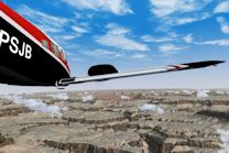
Virtual Tour Description::_________________________________________________________Click image for the tour
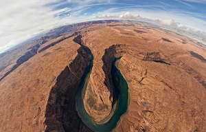
The second part of the tour series begins as w fly over Whitmore Wash. We
continue to be able to see our destination at the Grand Canyon South Rim 65
miles east ahead of us as we pass over more popular Grand Canyon Rapids
at 195 Knots. Included are 185 Mile Rapids, Lower Lava Rapids and Lava Fall
Rapids with treacherous level 8-10 rapids. We end this
part of . . . more.
Be sure to use the accompanying Google Map in Earth mode to help identify the sights.
View Gateway Rapids To Whitmore Wash in a larger map Back To Top
Grand Canyon West Tour Part 3 - Upset Rapids To Gateway Rapids
Before starting the 3rd Virtual Grand Canyon west tour here's another real experience:
An airplane and ground tour over the Grand Canyon West Rim, Hoover Dam and Lake Mead that includes a
landing at the Haulapai Indian Reservation where you will begin a 4-mile bus ride on the "High Indian Mesa of
the West Rim" . You will have a 90 minute sightseeing stop at Guano Point for an authentic Hualapai Indian
BBQ Lunch and then to Eagle Point for more photo opportunities. I'll provide a link to a full page description
and itinerary of this and other Grand Canyon tours soon.
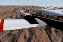
Virtual Tour Description::_________________________________________________________Click image for the tour
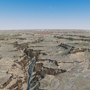
We are now around 43 miles west of Grand Canyon Village on this third part of
the Grand Canyon West Virtual tour after passing over Gateway Rapids. We
continue west flying high over less difficult rapids like Fern Glen Rapids, 164
Mile Rapids, Havasu Canyon Rapids, Sinyala Rapids and finally Upset Rapids
which is said to have difficulty level 3 - 8
rapids. We also . . . more.
Be sure to use the accompanying Google Map in Earth mode to help identify the sights.
View Upset Rapids To Gateway Rapids in a larger map Back To Top
Grand Canyon West Tour Part 4 - Tapeats Rapids To Kanab Rapids
Before starting the 3rd Virtual Grand Canyon west tour here's another real experience:
An airplane and ground tour over the Grand Canyon West Rim, Hoover Dam and Lake Mead that includes a
landing at the Haulapai Indian Reservation where you will begin a 4-mile bus ride on the "High Indian Mesa of
the West Rim" . You will have a 90 minute sightseeing stop at Guano Point for an authentic Hualapai Indian
BBQ Lunch and then to Eagle Point for more photo opportunities. I'll provide a link to a full page description
and itinerary of this and other Grand Canyon tours soon.
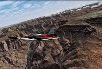
Virtual Grand Canyon West Tour Description::_________________________________Click image for the tour
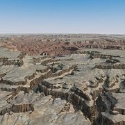
Beginning our fourth part of the Virtual Grand Canyon West Tour now at
around 32 miles west of Grand Canyon Village, we can observe our flight over
Matkatamiba Rapids and Kanab Rapids as we continue to fly high over some
impressive Grand Canyon rafting waters such as Fishtail Rapids, Doris Rapids,
Deer Creek Falls, Granite Narrows, 135 Mile Rapids and finally . . . more.
Be sure to use the accompanying Google Map in Earth mode to help identify the sights.
View Tapeats Rapids To Kanab Rapids in a larger map Back To Top
Check back for new Virtual Travel Tours, or Subscribe to VTT RSS Feed for updates.
Please Comment and Share
Back To Top


New! Comments
This site is still in its development stage. Please let me know what you think about this page.